AquaModel provides a real-time, three-dimensional simulation of the growth and metabolic activity of penned fish as well as the associated flow and transformation of nutrients, oxygen, and particulate wastes in adjacent waters and sediments. It runs on Windows personal computers and has drop down menus and a help menu and can be operated on different levels of complexity to suit the needs of the user.
AquaModel is being used as a consulting tool and can be provided as a complete package to governments under licensing requirements.
Partial funding for the development of AquaModel has been provided by the United States Department of Agriculture and the National Oceanic and Atmospheric Administration. More information about development under this funding can be found at: Software for Sustainable Development of Open Ocean Fish Farms (USDA) and Aquaculture Site Selection An Ecosystem Approach (NOAA)


AquaModel - now a plug-in of EASy
AquaModel


Features
AquaModel is a "plug-in" model that resides within the EASy Marine Geographic Information System (www.runeasy.org) which has been used on numerous studies and investigations involving fisheries and oceanographic topics. All environmental information from field measurements to satellite imagery are readily available for model development and use.
Learn more
Users
AquaModel is designed for:
AquaModel is designed for:
- Administrators, who establish and enforce rules and evaluate ecological impact,
- Fish farmers, who wish to plan farms and obtain permits and
- Investors, who wish to assess risks and opportunities.
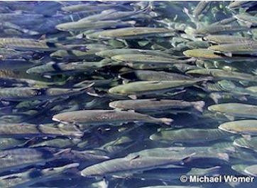
Aquaculture
Open Ocean and Coastal Aquaculture:
AquaModel can be used to examine near and far field effects of individual farms or clusters of farms in the coastal shelf where nearshore or open-ocean aquaculture may develop. It is being used to model multiple separate cages and multiple farm sites to meet this challenge.
Learn more
About EASy
EASy is an advanced Geographical Information System (GIS) with the capability to view, analyze and store diverse types of environmental data. Unlike other GIS software, EASy has been specifically designed to display data utilizing time, depth and geo-spatial information. This dynamic 3-D capability is vital for studying marine environments with their complex horizontal and vertical structures.
Learn more


AquaModel - At a Glance
Numerical models are increasingly important for planning and permitting of marine fish farms. Models range from simple one-box simulations to complex mainframe-oceanic models potentially capable of managing entire coastal systems.
AquaModel is an advanced information system to assess the operations and impacts of fish farms in both water column and benthic environments, the first of its kind.